2 adults

Rooms 1

ARB_Hund-Titelbild

My accommodation

2 adults

A good choice for your holiday:
Alpenstadt Bludenz

  • 163 landlords and hosts
  • 34 lifts and cable cars
  • 123 kilometers of pistes
  • Pure nature

A good choice for your holiday:
Brandnertal

  • 163 accommodations
  • 34 lifts and cable cars
  • 123 kilometers of pistes
  • Pure nature

A good choice for your holiday:
Klostertal

  • 163 landlords and hosts
  • 34 lifts and cable cars
  • 123 kilometers of pistes
  • Pure nature

A good choice for your holiday:
Biosphere reserve Großes Walsertal

  • 163 holiday properties
  • 34 lifts and cable cars
  • 123 kilometers of pistes
  • Pure nature

Rooms 1

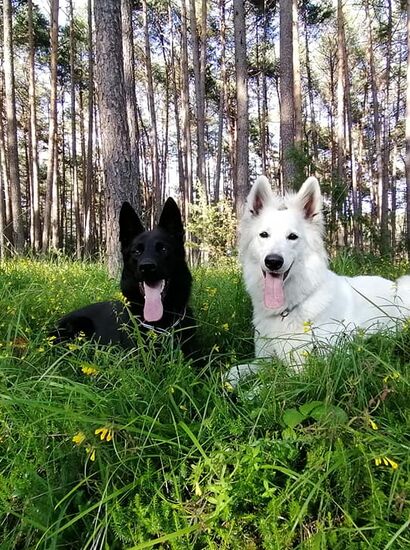
Holiday with your dog

Of course, man's best friends cannot be missing on a dreamy holiday in the Alpine region of Vorarlberg. Intensive time and shared experiences strengthen the bond between man and dog, and between mountains, alpine meadows and themed trails lie ideal conditions for discovering the unique landscape on four paws.

Rules of conduct for dog and owner

So that both - you and your dog - can have an unforgettable holiday experience in the alpine region of Vorarlberg, there are a few points to consider. Here you will find all the necessary tips for a carefree stay in the region.

Dogs must be kept on a leash in these areas

  • In public transport (buses, trains, cable cars) and their stops
  • In public buildings and facilities
  • In public playgrounds
  • On cycle paths, walking and hiking trails and cross-country skiing tracks
  • On agricultural land

Checklist for your holiday with your dog

  • Leash and muzzle: Even on the mountain, certain rules apply and situations may arise from time to time that require a leash. It certainly doesn't hurt to have a muzzle with you.
  • Drinking water: Not only humans long for a glass of water after a strenuous hike, the dog should also be sufficiently supplied.
  • Food: Just like a thirst quencher, your dog should also be provided with sufficient food during a hike.
  • Towel: A small towel that can be used after a surprising rain shower or a well-deserved bath should not be missing either.
  • Dog excrement bags: Dog excrement should always be removed, not only in the valley but also on the mountain. It is important not to pollute paths and landscapes unnecessarily. Did you know that grazing animals can become seriously ill from dog excrement?
  • Tip: ROBIDOG - The dog toilet: You will find the green dog excrement disposal system at almost all walking and hiking trails in the Vorarlberg Alpine Region. Here you can immediately dispose of your dog's waste in a professional manner.
  • EU pet passport: Not only as a human being should you be able to identify yourself, your four-legged friend also needs proof of identity.

What can I trust my dog to do on holiday?

Dogs should do on holiday what they are used to doing at home. If the dog is used to a leisurely pace in everyday life and gets less exercise, it will not be a long-distance dog on holiday either. If you plan to hike in the mountains with your dog and know that he needs endurance for this, start getting the dog used to such distances early enough.

On the way with public transport

Bus & Train

On buses & trains, dogs travelling must be secured with a leash AND muzzle.
A dog always needs a ticket.
A day ticket costs EUR 1.90, a week ticket EUR 7.20 and a monthly ticket EUR 15.00.

Dogs can be taken free of charge and without a muzzle and leash.

  • If the dog is transported in a closed container.
  • For partner dogs for people with disabilities
  • For guide dogs, assistance dogs and dogs for the blind

Mountain cable cars

In the Brandnertal (Bergbahnen Brandnertal), in the Klostertal (Sonnenkopfbahn) and also in the Große Walsertal (cable car Sonntag-Stein) dogs are allowed and free of charge.

In general, leashes are compulsory in large-capacity gondolas and a muzzle is recommended.

Hikes with a dog

Spending time in the mountains together with your dog is not only fun, it also bonds you as a team. However, you should consider some of our tips before you start your hike.

The route should be chosen to suit the dog's health and fitness. Young dogs should have completed the growth phase. Hikes that are too long are a strain on bones and joints that are still growing.

Pay attention to signals from your four-legged friend. A dog cannot sweat, only pant. Breaks help against overheating: You can recognise an exhausted dog by a blue tongue.

We also recommend a chest harness instead of a collar when hiking in the mountains.

Now it's simply "WAU" - enjoy the most beautiful hiking trails in the region with your dog!

Hikes

Natursprünge-Weg | Brandnertal

Natursprünge-Weg | Brandnertal

Natursprünge-Weg | Brandnertal

Length4,6 km Elevation gain38 m LevelEasy Duration2:00 h

Learn about the nature of the Brandner Valley at eleven interactive stations along the Natursprünge-Weg! Fun and games for young and old are guaranteed along this trail in summer!

Panoramabahn mountain station or Dorfbahn mountain station, Brand.

Panoramabahn mountain station or Dorfbahn mountain station, Brand.

Alvierbachweg | Brand

Alvierbachweg | Brand

Alvierbachweg | Brand

Length4,9 km Elevation gain75 m LevelEasy Duration1:30 h

Quiet, partly shady walk along the Alvierbach stream in Brand.

Village centre, Brand

Village centre, Brand

Lünersee circular trail | Brand

Lünersee circular trail | Brand

Lünersee circular trail | Brand

Length7,7 km Elevation gain506 m LevelEasy Duration2:00 h

The Lünersee circular trail is the ideal hike for families and offers fantastic views of the Lünersee and the Rätikon mountains.

Lünersee cable car valley station, Brand

Lünersee cable car valley station, Brand

Parpfienz circuit | Brand

Parpfienz circuit | Brand

Parpfienz circuit | Brand

Length6,2 km Elevation gain571 m LevelEasy Duration1:30 h

This easy hike is worthwhile because of the great blooms, especially in early summer.

Mountain station Dorfbahn Brand

Mountain station Dorfbahn Brand

To the Kesselfall | Brand

To the Kesselfall | Brand

To the Kesselfall | Brand

Length2,4 km Elevation gain99 m LevelEasy Duration1:00 h

Leisurely hike to the waterfall "Kesselfall", which is located in an impressive rock gorge in Brand.

Car park Innertal, Brand

Car park Innertal, Brand

Schattenlagant Hütte | Brand

Schattenlagant Hütte | Brand

Schattenlagant Hütte | Brand

Length7,7 km Elevation gain423 m LevelEasy Duration2:45 h

Leisurely hike along the Alvierbach stream, past the Kesselfall, to the Schattenlagant hut, where you can stop for a leisurely meal.

Innertal, Brand

Innertal, Brand

Heinrich-Hueter Hütte | Brand

Heinrich-Hueter Hütte | Brand

Heinrich-Hueter Hütte | Brand

Length11,1 km Elevation gain1067 m LevelModerate Duration4:30 h

Hike from the Brandnertal valley into the Rellstal valley to the Heinrich-Hueter hut.

Lünerseebahn valley station, Brand

Lünerseebahn valley station, Brand

To the Sarotla Hut | Brand

To the Sarotla Hut | Brand

To the Sarotla Hut | Brand

Length11,0 km Elevation gain773 m LevelModerate Duration4:00 h

At the foot of the Zimba, the Zwölferkopf and the Gottvaterspitze lies the rustic Sarotla Hut at the end of the Sarotla Valley.

Village center, Brand

Village center, Brand

To the Untere Brüggele Alpe | Brand

To the Untere Brüggele Alpe | Brand

To the Untere Brüggele Alpe | Brand

Length7,0 km Elevation gain410 m LevelEasy Duration2:30 h

Hike through the unspoiled Zalim valley past the Glingabrunnen fountain to the Untere Brüggele Alpe.

Innertal, Brand

Innertal, Brand

Kulinarische Genussrunde | Brand

Kulinarische Genussrunde | Brand

Kulinarische Genussrunde | Brand

Length11,7 km Elevation gain192 m LevelModerate Duration3:30 h

Unterwegs besuchen Sie drei Genuss-Stationen und werden von den Gastgebern mit regionalen Köstlichkeiten verwöhnt.

Talstation Dorfbahn, Brand

Talstation Dorfbahn, Brand

Kulinarische Genussrunde | Bürserberg

Kulinarische Genussrunde | Bürserberg

Kulinarische Genussrunde | Bürserberg

Length14,4 km Elevation gain869 m LevelModerate Duration4:45 h

Bei diesem kulinarischen Angebot ist der Name Programm: Sportlich aktiv sein und gleichzeitig genießen.

Talstation Einhornbahn II, Bürserberg

Talstation Einhornbahn II, Bürserberg

Burtschasattel circuit hiking | Bürserberg

Burtschasattel circuit hiking | Bürserberg

Burtschasattel circuit hiking | Bürserberg

Length4,3 km Elevation gain255 m LevelModerate Duration1:45 h

Leisurely round tour from the Burtschasattel down towards Tschengla and back via the Burtscha Alpe.

Burtschasattel, Bürserberg

Burtschasattel, Bürserberg

Furkla-Höhenweg l Bürserberg

Furkla-Höhenweg l Bürserberg

Furkla-Höhenweg l Bürserberg

Length10,8 km Elevation gain317 m LevelEasy Duration3:15 h

Below the Alpilakopf, the Schillerkopf and the Mondspitze, the path leads to the Furkla Alpe and offers a fabulous view of the mountains of the Rätikon.

Panoramabahn mountain station, Bürserberg

Panoramabahn mountain station, Bürserberg

Loischkopfrundweg | Bürserberg

Loischkopfrundweg | Bürserberg

Loischkopfrundweg | Bürserberg

Length4,6 km Elevation gain210 m LevelModerate Duration1:45 h

Easy circular trail around the Loischkopf.

Burtschasattel, Bürserberg

Burtschasattel, Bürserberg

Mottakopfweg | Bürserberg

Mottakopfweg | Bürserberg

Mottakopfweg | Bürserberg

Length4,6 km Elevation gain137 m LevelEasy Duration1:30 h

Pleasantly short hike to Mottakopf on the Tschengla high plateau.

Car park Tschengla, Bürserberg

Car park Tschengla, Bürserberg

Tschengla circular trail | Bürserberg

Tschengla circular trail | Bürserberg

Tschengla circular trail | Bürserberg

Length1,8 km Elevation gain59 m LevelEasy Duration0:45 h

Family-friendly hike on the sunny Tschengla high plateau.

Hikers' parking lot Tschengla, Bürserberg

Hikers' parking lot Tschengla, Bürserberg

To the waterfall "Ausserberg" | Bürserberg

To the waterfall

To the waterfall "Ausserberg" | Bürserberg

Length4,9 km Elevation gain127 m LevelEasy Duration1:30 h

The waterfall at Ausserberg is a very worthwhile destination and is also very popular with families with children.

Municipal office, Bürserberg

Municipal office, Bürserberg

Illweg | Bürs

Illweg | Bürs

Illweg | Bürs

Length4,7 km Elevation gain12 m LevelEasy Duration1:15 h

Leisurely walk through Bürs and along the Ill River.

Zimbapark Bürs

Zimbapark Bürs

Fairy Tale & Legend Trail | Bürs

Fairy Tale & Legend Trail | Bürs

Fairy Tale & Legend Trail | Bürs

Length2,9 km Elevation gain73 m LevelEasy Duration1:00 h

A beautiful adventure trail in Bürs on which local legends and fairy tales are told.

Village Center, Bürs

Village center, Bürs

Hiking trail "Biotop Schloss Rosenegg"

Hiking trail

Hiking trail "Biotop Schloss Rosenegg"

Length2,8 km Elevation gain71 m LevelEasy Duration1:30 h

Easy circular hike to the biotope and the ruins of Rosenegg Castle in Bürs.

Municipal office in Bürs

Municipal office in Bürs

Kulturweg "Historischer Dorfrundweg" | Nüziders

Kulturweg

Kulturweg "Historischer Dorfrundweg" | Nüziders

Length8,7 km Elevation gain512 m LevelEasy Duration3:30 h

Interessanter Kulturweg zu historischen Plätzen in der Sonnenberg Gemeinde Nüziders.

St. Viner Kirche, Nüziders

St. Viner Kirche, Nüziders

Circular trail to Sonnenberg Ruin | Nüziders

Circular trail to Sonnenberg Ruin | Nüziders

Circular trail to Sonnenberg Ruin | Nüziders

Length3,7 km Elevation gain159 m LevelEasy Duration1:15 h

A scenic hiking trail above Nüziders, past the Sonnenberg ruin.

Village centre, Nüziders

Village centre, Nüziders

Short Muttersberground to the pond | Bludenz-Nüziders

Short Muttersberground to the pond | Bludenz-Nüziders

Short Muttersberground to the pond | Bludenz-Nüziders

Length1,4 km Elevation gain75 m LevelEasy Duration0:35 h

Short, leisurely hike on the Muttersberg, which is well suited for families with small children.

Muttersberg cable car mountain station, Bludenz

Muttersberg cable car mountain station, Bludenz

Madeisa circular walk | Bludenz-Nüziders

Madeisa circular walk | Bludenz-Nüziders

Madeisa circular walk | Bludenz-Nüziders

Length1,0 km Elevation gain51 m LevelEasy Duration0:25 h

Short, easy circular trail on Muttersberg and therefore very suitable for families with small children.

Muttersberg cable car mountain station, Bludenz

Muttersberg cable car mountain station, Bludenz

Sunna-Weg: Etappe 1 | Nüziders-Bludenz

Sunna-Weg: Etappe 1 | Nüziders-Bludenz

Sunna-Weg: Etappe 1 | Nüziders-Bludenz

Length4,3 km Elevation gain229 m LevelEasy Duration1:30 h

Along the municipalities of Nüziders, Bludenz and Braz, a new cultural-historical theme trail, the "Sunna Trail", will inspire visitors from summer 2019. The first stage leads from the "Hängeder...

Parkingstation at the "Hängender Stein", Nüziders

"Daneu" bridge, Bludenz

Sunna-Weg: Etappe 2 | Bludenz

Sunna-Weg: Etappe 2 | Bludenz

Sunna-Weg: Etappe 2 | Bludenz

Length3,9 km Elevation gain249 m LevelEasy Duration1:30 h

Along the municipalities of Nüziders, Bludenz and Braz, a new cultural-historical theme trail, the "Sunna Weg", will inspire visitors from summer 2019. The second stage leads from the Daneu bridge in...

Daneu bridge, Bludenz

Rungelin, Bludenz

Sunna-Weg: Etappe 3 | Bludenz-Außerbraz

Sunna-Weg: Etappe 3 | Bludenz-Außerbraz

Sunna-Weg: Etappe 3 | Bludenz-Außerbraz

Length4,9 km Elevation gain108 m LevelEasy Duration1:30 h

Along the municipalities of Nüziders, Bludenz and Braz, a new cultural-historical theme trail, the "Sunna Weg", will delight visitors from summer 2019. The third stage leads from Rungelin in Bludenz...

Rungelin, Bludenz

TRAUBE BRAZ Alpen.Spa.Golf.Hotel, Außerbraz

Alpine Art Muttersberg - Art Trail | Bludenz

Alpine Art Muttersberg - Art Trail | Bludenz

Alpine Art Muttersberg - Art Trail | Bludenz

Length3,9 km Elevation gain100 m LevelModerate Duration1:15 h

The Muttersberg becomes an open-air gallery! On the way along the art trail on the Muttersberg!

Muttersberg cable car mountain station, Bludenz

Muttersberg cable car mountain station, Bludenz

Kulturweg "Industriekultur" | Bludenz

Kulturweg

Kulturweg "Industriekultur" | Bludenz

Length2,2 km Elevation gain16 m LevelEasy Duration0:45 h

Diese Kulturroute verbindet vier wichtige, zum Teil nicht mehr in der ursprünglichen Form genutzte Industriebauten sowie das Gründerhaus der Firma Getzner, Mutter & Cie. mitten in der Altstadt zu...

Fabrik Klarenbrunn, Bludenz

Stadthaus 38 (Altstadt), Bludenz

Montikel panoramic trail | Bludenz

Montikel panoramic trail | Bludenz

Montikel panoramic trail | Bludenz

Length4,6 km Elevation gain205 m LevelEasy Duration1:45 h

Very beautiful panoramic trail close to the city with many resting benches and beautiful viewpoints.

Water castle (on the right hand side of the valley station Muttersbergbahn), Bludenz

Leisure pool VAL BLU, Bludenz

Muttersberg - Alpe Els | Bludenz

Muttersberg - Alpe Els | Bludenz

Muttersberg - Alpe Els | Bludenz

Length11,6 km Elevation gain357 m LevelModerate Duration3:30 h

Hike to the idyllic Alpe Els, situated under the Gamsfreiheit. A refreshment stop is worthwhile!

Muttersberg cable car mountain station, Bludenz

Muttersberg cable car mountain station, Bludenz

Circular route to the acoustic resting place "Hellwald" | Bludenz

Circular route to the acoustic resting place

Circular route to the acoustic resting place "Hellwald" | Bludenz

Length5,5 km Elevation gain314 m LevelEasy Duration2:15 h

Beautiful circular trail above Bludenz to the "Hellwald" acustic rest stop, which provides playful sound entertainment for young and old. 

Leisure pool Val Blu, Bludenz

Leisure pool Val Blu, Bludenz

Forest educational trail | Bludenz

Forest educational trail | Bludenz

Forest educational trail | Bludenz

Length2,3 km Elevation gain109 m LevelEasy Duration1:00 h

Educational forest walk above Bludenz.

Wasserschloss (on the right hand side of the valley station Muttersberg cable car), Bludenz.

Leisure pool Val Blu, Bludenz

Rundwanderung Tobelfeld Braz

Rundwanderung Tobelfeld Braz

Rundwanderung Tobelfeld Braz

Length6,8 km Elevation gain81 m LevelEasy Duration2:00 h

Peaceful circular walk, sometimes passing through meadows and shady woods.

Municipal office Innerbraz (Tobel)

Municipal office Innerbraz (Tobel)

Rundwanderung Unterrifats Braz

Rundwanderung Unterrifats Braz

Rundwanderung Unterrifats Braz

Length4,9 km Elevation gain89 m LevelEasy Duration1:25 h

Pretty circular walk along partially shady Alfenz bank, passing the golf course on the north side of the valley, back to the starting point.

Alpen.Spa.Golf.Hotel Traube Braz

Alpen.Spa.Golf.Hotel Traube Braz

Panorama Trail | Klösterle am Arlberg

Panorama Trail | Klösterle am Arlberg

Panorama Trail | Klösterle am Arlberg

Length5,5 km Elevation gain165 m LevelModerate Duration1:45 h

Enjoy great views along the panoramic circular trail from Klösterle to Danöfen and back.

Tourist Office, Klösterle am Arlberg

Tourist Office, Klösterle am Arlberg

Hiking circuit Klösterle am Arlberg

Hiking circuit Klösterle am Arlberg

Hiking circuit Klösterle am Arlberg

Length3,2 km Elevation gain122 m LevelEasy Duration1:00 h

Beautiful, leisurely circular hike in Klösterle am Arlberg with detour to Nenzigast waterfall

Tourist Office, Klösterle am Arlberg

Tourist Office, Klösterle am Arlberg

Alpe Nenzigast | Klösterle am Arlberg

Alpe Nenzigast | Klösterle am Arlberg

Alpe Nenzigast | Klösterle am Arlberg

Length9,2 km Elevation gain581 m LevelEasy Duration3:00 h

Leisurely hike to the Alpe Nenzigast in the beautiful Nenzigast Valley.

Centre, Klösterle am Arlberg

Centre, Klösterle am Arlberg

Bärenland & Bären-Weg at the Sonnenkopf | Klösterle am Arlberg

Bärenland & Bären-Weg at the Sonnenkopf | Klösterle am Arlberg

Bärenland & Bären-Weg at the Sonnenkopf | Klösterle am Arlberg

Length2,3 km Elevation gain847 m LevelEasy Duration0:30 h

The "Bärenland" on the adventure and family mountain Sonnenkopf is the right thing for little adventurers.

Mountain station Sonnenkopfbahn

Mountain station Sonnenkopfbahn

Village Circuit | Dalaas

Village Circuit | Dalaas

Village Circuit | Dalaas

Length3,0 km Elevation gain99 m LevelEasy Duration0:45 h

Leisurely village tour through numerous parts of the vacation resort Dalaas in Klostertal.

Klostertal Tourism Office

Klostertal Tourism Office

Kulturweg "Haselfichte" | Dalaas

Kulturweg

Kulturweg "Haselfichte" | Dalaas

Length3,3 km Elevation gain- LevelEasy Duration1:00 h

Dieser Kulturweg lädt ein die Besonderheiten der Haselfichte und ihre Klangskulpturen kennenzulernen.

Volksschule, Wald am Arlberg

Gemeindeamt, Dalaas

Muttjöchle, 2.074 m | Dalaas

Muttjöchle, 2.074 m | Dalaas

Muttjöchle, 2.074 m | Dalaas

Length7,9 km Elevation gain1081 m LevelEasy Duration1:45 h

Beautiful family hike past idyllic high moors and blooming mountain meadows.

Sonnenkopf cable way mountain station, Dalaas

Bergstation Sonnenkopfbahn, Dalaas

Around the Formarinsee | Dalaas

Around the Formarinsee | Dalaas

Around the Formarinsee | Dalaas

Length4,7 km Elevation gain143 m LevelEasy Duration1:30 h

Leisurely hike at alpine heights around the Formarinsee lake with a view of the mighty Rote Wand.

Bus stop Alpe Formarin

Bus stop Alpe Formarin

Rundwanderung Garmauscha - Kaiser | Dalaas

Rundwanderung Garmauscha - Kaiser | Dalaas

Rundwanderung Garmauscha - Kaiser | Dalaas

Length4,2 km Elevation gain218 m LevelEasy Duration1:30 h

Diese Wanderung ist auch sehr gut bei Regen möglich, worüber sich meist die Kinder freuen, wenn sie in die Pfützen springen dürfen.

Parking place Kristbergsaal

Parking place Kristbergsaal

Village circular path | Wald am Arlberg

Village circular path | Wald am Arlberg

Village circular path | Wald am Arlberg

Length4,4 km Elevation gain104 m LevelEasy Duration1:25 h

Leisurely village tour along the Alfenz river and through numerous districts of the vacation resort Wald am Arlberg in the Klostertal valley.

Sonnenkopf cable car valley station, Wald am Arlberg

Sonnenkopf cable car valley station, Wald am Arlberg

Kulinarische Genussrunde | Großes Walsertal

Kulinarische Genussrunde | Großes Walsertal

Kulinarische Genussrunde | Großes Walsertal

Length12,2 km Elevation gain464 m LevelModerate Duration4:15 h

Zu Fuß über saftige Alpwiesen wandern und das atemberaubende Bergpanorama immer im Blick haben, frische Berglufteinatmen und sich bei drei Genuss-Stationen mit regionalen Köstlichkeiten verwöhnen...

Talstation Seilbahn Sonntag-Stein, Sonntag

Talstation Seilbahn Sonntag-Stein, Sonntag

Bad Rothenbrunnen | Sonntag-Buchboden

Bad Rothenbrunnen | Sonntag-Buchboden

Bad Rothenbrunnen | Sonntag-Buchboden

Length5,2 km Elevation gain290 m LevelEasy Duration1:30 h

Enjoy the hike into the valley along the stream to the beautifully situated alpine inn Bad Rothenbrunnen in the Gadental valley.

Church, Sonntag-Buchboden

Church, Sonntag-Buchboden

Klangraum.Stein | Sonntag

Klangraum.Stein | Sonntag

Klangraum.Stein | Sonntag

Length4,0 km Elevation gain118 m LevelEasy Duration1:30 h

Experience a special sound experience in the mountains of the Great Walser Valley.

Mountain station cable cars Sonntag-Stein

Mountain station cable cars Sonntag-Stein

Water Hike | Sonntag-Buchboden

Water Hike | Sonntag-Buchboden

Water Hike | Sonntag-Buchboden

Length8,0 km Elevation gain100 m LevelEasy Duration2:30 h

Beautiful hike to special water places in the biosphere park Großes Walsertal: Natural monument Kessena (gorge), iron spring Bad Rothenbrunnen, tuff spring and sulfur spring.

Church, Sonntag-Buchboden

Church, Sonntag-Buchboden

Unterpartnom - Oberpartnom - Steris | Sonntag

Unterpartnom - Oberpartnom - Steris | Sonntag

Unterpartnom - Oberpartnom - Steris | Sonntag

Length9,9 km Elevation gain457 m LevelModerate Duration3:30 h

The panoramic hike from Alpe Steris over the Upper and Lower Partnom Alps is perfect for connoisseurs.

Cable way Sonntag mountain station, Sonntag

Cable way Sonntag mountain station, Sonntag

Forest Experience Trail | Marul

Forest Experience Trail | Marul

Forest Experience Trail | Marul

Length3,5 km Elevation gain136 m LevelEasy Duration1:30 h

Three adventure trails of different lengths in the Großes Walsertal Biosphere Park offer plenty of variety and fun for the whole family, but also interesting facts for anyone interested in nature.

Car park Marul, Raggal

Car park Marul, Raggal

Wiesweg via Labom | Raggal

Wiesweg via Labom | Raggal

Wiesweg via Labom | Raggal

Length5,8 km Elevation gain164 m LevelEasy Duration2:00 h

On this easy hike you can expect a magnificent view over the Walgau region all the way to the Swiss mountains.

Raggal church

Raggal church

Wiesweg | Raggal - Ludescherberg

Wiesweg | Raggal - Ludescherberg

Wiesweg | Raggal - Ludescherberg

Length3,3 km Elevation gain125 m LevelEasy Duration1:00 h

In spring as well as in early summer you can discover the colorful variety of meadows at the Ludescherberg

Raggal church

Ludescherberg

Via the Stafelalpsee to the Fanz-Josef-Hütte | Fontanella-Faschina

Via the Stafelalpsee to the Fanz-Josef-Hütte | Fontanella-Faschina

Via the Stafelalpsee to the Fanz-Josef-Hütte | Fontanella-Faschina

Length4,5 km Elevation gain247 m LevelModerate Duration1:45 h

Leisurely hike for connoisseurs to the Stafelalpsee and further to the Franz-Josef-Hütte.

Parking lot at the Faschinajoch, Fontanella-Faschina

Parking lot at the Faschinajoch, Fontanella-Faschina

To the Seewaldsee | Fontanella

To the Seewaldsee | Fontanella

To the Seewaldsee | Fontanella

Length4,3 km Elevation gain112 m LevelEasy Duration1:00 h

The hike to the Seewaldsee is eventful from spring to autumn in any weather and offers a wonderful panoramic view over the Grosse Walsertal.

Fontanella-Säge, Fontanella

Seewaldsee, Fontanella

Leusorgweg | Blons

Leusorgweg | Blons

Leusorgweg | Blons

Length9,1 km Elevation gain587 m LevelModerate Duration2:30 h

The Leusorgweg, two other avalanche paths (Schutzwald- & Verbauungsweg) and an avalanche documentation center with video and image material today commemorate the avalanche disaster of 1954.

Community Center, Blons

Community Center, Blons

Gampelin Alpe - Schnifis | Thüringerberg

Gampelin Alpe - Schnifis | Thüringerberg

Gampelin Alpe - Schnifis | Thüringerberg

Length11,4 km Elevation gain379 m LevelModerate Duration3:30 h

Discover the natural landscape from Thüringerberg to Schnifis.

Local center, Thüringerberg

Local center, Thüringerberg

Walserweg | Thüringerberg - Damüls

Walserweg | Thüringerberg - Damüls

Walserweg | Thüringerberg - Damüls

Length20,2 km Elevation gain1148 m LevelDifficult Duration8:00 h

In earlier times, when there were no roads in the Great Walser Valley, the individual villages were only connected by footpaths. Today, these footpaths form the historic Walserweg. 

Thüringerberg

Damüls

Damüls | Zur Alpe Unterdamüls

Damüls | Zur Alpe Unterdamüls

Damüls | Zur Alpe Unterdamüls

Length5,6 km Elevation gain180 m LevelEasy Duration2:00 h

Damüls Kirchdorf - Alpe Unterdamüls - Damüls Kirchdorf

Damüls Kirchdorf

Damüls Kirchdorf

Dog-friendly accommodation

Establishments with four-paw quality welcome not only their owners, but also your dog.

Below you will find all the accommodations in our region that are dog-friendly.

A little tip: When booking, let us know that your dog will be travelling with you. This way there will be no misunderstandings and your dog will also be welcomed happily.

Accommodation

Bathing with your dog

In principle, bathing in public waters is prohibited. However, there are a few exceptions which are permitted until further notice.

Waters

Dogs are allowed to bathe at the Ill in Bludenz. We recommend sheltered places and times with low water levels.

Dogs are allowed to bathe in the Lutzbach in the Großes Walsertal Biosphere Park, in the Alfenz in Klostertal and also in the Alvierbach in Brandnertal.

Swimming pools

Alvierbad Brand
You may bring your dog into the kiosk area at the Alvierbrand in Brand. The sunbathing lawn and also the water area are forbidden for the four-legged friends.

Braz Swimming Pool
Dogs are allowed in the kiosk area of the Braz swimming pool. Dogs are not allowed on the sunbathing lawn or in the water area.

Dogs are strictly prohibited in the Almwasserpark in Klösterle am Arlberg, the Val Blu leisure pool and the Dalaas outdoor pool.

Dog service

Here you will find all the information you need about your faithful companion.

Vets

Bludenz

  • Veterinary Team Bludenz | Pulverturmstraße 6, 6700 Bludenz
  • Veterinary practice Dr. med. vet. Wolfgang Burtscher | Spitalgasse 18, 6700 Bludenz

Nüziders

  • Veterinary practice Dr. Andrea Lackner-Oberle | Katils Werkstraße 5, 6714 Nüziders
  • Veterinary surgeons Tschabrun | Elserweg 8a, 6714 Nüziders

Thüringerberg

  • Tierärzte Dr. Herbert Lorenzin & Mag. Silke Lorenzin | Thüringerberg 254, 6721 Thüringerberg

Dog Sitters

  • Mobile Animal Care – Mobile Tierpflege | Klostertalerstraße 99, 6752 Dalaas
  • Hundesitter im Bundesland Vorarlberg

Food for your dog

  • Basically you can find pet food in all grocery shops in the alpine region of Vorarlberg (supermarkets, Spar, Sutterlüty, etc.)
  • Fressnapf Bludenz | Wichnerstraße 14, 6700 Bludenz

Dog sports / Dog training

  • Bludenz Dog Sports Club | Brunnenfelderstraße 43, 6700 Bludenz
  • Freilauf Dog School and Shop | Wichnerstraße 10 b, 6700 Bludenz
  • Nüziders Dog Sports Club | Illweg 21, 6714 Nüziders

Dog salon

  • Dog salon for all coats | Katils Werkstraße 5, 6714 Nüziders

Dog breeding

  • Vom Hof Sandbühel – Bernese mountain dogs | Raggal 101, 6741 Raggal
  • Sonja Burtscher – Breeding of White Finess | Klostertalerstraße 66, 6751 Ausserbraz

Information about the current situation:

Current situation:

close

A short moment

We prepare the content…

Discover theRegion

map

Discover three valleys and one alpine town

Alprenregion voralrbergÜbersichtBrandnertalBludenzKlostertalWalsertal

Welcome to Brandnertal

A winter hike through the snowy landscape, fun on the slopes in the Brandnertal ski area, cross-country skiing on the Tschengla or a toboggan safari: every day in Brandnertal holds a new winter experience for active nature lovers and families in store. The three villages in Brandnertal - Bürs, Bürserberg and Brand - offer the ideal environment, always accompanied by a mountain panorama, warm hosts and regional delicacies.

To Brandnertal

Welcome to the Alpine Town of Bludenz

The Alpine Town of Bludenz forms the centre of the 5 surrounding valleys and combines nature, culture and city in a stimulating way. In winter the two towns - Bludenz and Nüziders - are ideal centres for skiers and winter sports enthusiasts: ten ski areas can be reached within a few minutes drive.

To the Alpine Town

Welcome to Klostertal

Klostertal provides intensive encounters with nature at the foot of the Arlberg. In winter skiers enjoy the pure natural snow slopes on the Sonnenkopf or the vastness of the nearby Ski Arlberg area. Those seeking tranquillity encounter the untouched nature on snowshoes or relax on cross-country ski trails and the winter hiking trails. Off to sporting challenges and intense nature experiences in Braz, Dalaas/Wald am Arlberg and Klösterle am Arlberg!

To Klostertal

Biosphere Reserve Großes Walsertal

Inhale - exhale - breathe deeply. Winter in the biosphere reserve is above all one thing: relaxing. Start the day with a delicious breakfast buffet, hike on snowshoes over white mountain slopes, make your turns on the slopes or simply read a good book in front of the fireplace. Free from the hustle and bustle of everyday life, you will discover an intact natural landscape, complemented by culinary specialities and warm hosts.

To Großes Walsertal
BürserbergBürsBrandThüringerbergSt.GeroldBlonsRaggalSonntagFontanellaFaschinaNüzidersBludenzBrazDalaasWald am ArlbergKlösterle am Arlberg