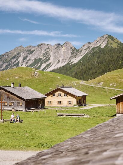
Your Mountain Weather at a Glance
Current conditions and forecast for the region
Find out here what the current weather is like and what to expect over the next few days. Stay informed about sun, rain or snow so that you can plan your stay and activities optimally and make every moment in the mountains unforgettable.
Brandnertal
Friday 15.05.2026
Mostly cloudy and rain, which will increase more and more.
Weather today
Morning
- Snow line1200 m
- Probability of precipitation15 %
- Probability of thunderstorms10 %
- Wind0 km/h, SW
- Sun0.2 h
Noon
- Snow line1500 m
- Probability of precipitation80 %
- Probability of thunderstorms25 %
- Wind5 km/h, NO
- Sun0 h
Evening
- Snow line1400 m
- Probability of precipitation90 %
- Probability of thunderstorms25 %
- Wind5 km/h, NW
- Sun0.4 h
3-day-forecast
Saturday, 16.05.2026
- Snow line1300 m
- Probability of precipitation80 %
- Probability of thunderstorms20 %
- Sunrise05:45
- Sunset20:51
Sunday, 17.05.2026
- Snow line1800 m
- Probability of precipitation5 %
- Probability of thunderstorms0 %
- Sunrise05:43
- Sunset20:53
Monday, 18.05.2026
- Snow line2000 m
- Probability of precipitation75 %
- Probability of thunderstorms45 %
- Sunrise05:42
- Sunset20:54
Alpenstadt Bludenz & surroundings
Friday 15.05.2026
Mostly cloudy and rain, which will increase more and more.
Weather today
Morning
- Snow line1200 m
- Probability of precipitation15 %
- Probability of thunderstorms10 %
- Wind0 km/h, SO
- Sun0.2 h
Noon
- Snow line1500 m
- Probability of precipitation65 %
- Probability of thunderstorms25 %
- Wind5 km/h, NW
- Sun0.1 h
Evening
- Snow line1400 m
- Probability of precipitation85 %
- Probability of thunderstorms25 %
- Wind5 km/h, N
- Sun0.2 h
3-day-forecast
Saturday, 16.05.2026
- Snow line1300 m
- Probability of precipitation75 %
- Probability of thunderstorms10 %
- Sunrise05:44
- Sunset20:51
Sunday, 17.05.2026
- Snow line1800 m
- Probability of precipitation10 %
- Probability of thunderstorms10 %
- Sunrise05:43
- Sunset20:52
Monday, 18.05.2026
- Snow line2000 m
- Probability of precipitation70 %
- Probability of thunderstorms50 %
- Sunrise05:42
- Sunset20:54
Klostertal
Friday 15.05.2026
Fair in the early morning, then considerable cloudiness and frequent rain.
Weather today
Morning
- Snow line1100 m
- Probability of precipitation20 %
- Probability of thunderstorms10 %
- Wind5 km/h, S
- Sun0.3 h
Noon
- Snow line1400 m
- Probability of precipitation80 %
- Probability of thunderstorms20 %
- Wind5 km/h, N
- Sun0 h
Evening
- Snow line1400 m
- Probability of precipitation90 %
- Probability of thunderstorms25 %
- Wind5 km/h, NO
- Sun0 h
3-day-forecast
Saturday, 16.05.2026
- Snow line1400 m
- Probability of precipitation85 %
- Probability of thunderstorms5 %
- Sunrise05:43
- Sunset20:50
Sunday, 17.05.2026
- Snow line1700 m
- Probability of precipitation5 %
- Probability of thunderstorms0 %
- Sunrise05:42
- Sunset20:51
Monday, 18.05.2026
- Snow line2000 m
- Probability of precipitation75 %
- Probability of thunderstorms40 %
- Sunrise05:41
- Sunset20:53
Großes Walsertal
Friday 15.05.2026
Fair in the early morning, then considerable cloudiness and frequent rain.
Weather today
Morning
- Snow line1300 m
- Probability of precipitation20 %
- Probability of thunderstorms10 %
- Wind0 km/h, S
- Sun0.5 h
Noon
- Snow line1500 m
- Probability of precipitation80 %
- Probability of thunderstorms30 %
- Wind10 km/h, N
- Sun0.1 h
Evening
- Snow line1400 m
- Probability of precipitation90 %
- Probability of thunderstorms25 %
- Wind5 km/h, S
- Sun0.1 h
3-day-forecast
Saturday, 16.05.2026
- Snow line1300 m
- Probability of precipitation85 %
- Probability of thunderstorms10 %
- Sunrise05:43
- Sunset20:51
Sunday, 17.05.2026
- Snow line1800 m
- Probability of precipitation10 %
- Probability of thunderstorms10 %
- Sunrise05:42
- Sunset20:52
Monday, 18.05.2026
- Snow line2000 m
- Probability of precipitation75 %
- Probability of thunderstorms50 %
- Sunrise05:41
- Sunset20:54
