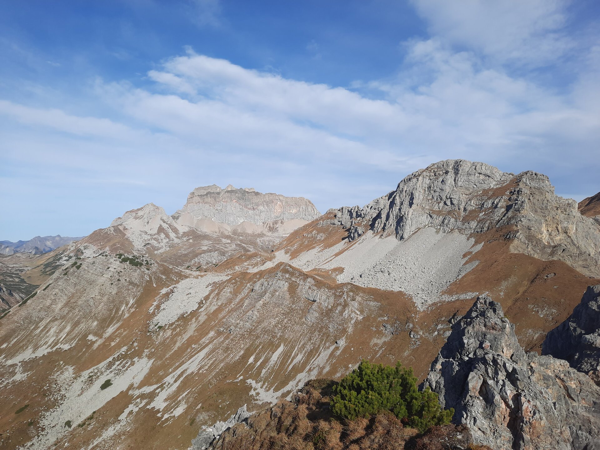
Saladinaspitze, 2.238 m | Dalaas

Distance7,2 km

Elevation gain482 m

Negative altitude482 m

LevelDifficult

Duration4:00 h

Distance7,2 km

Elevation gain482 m

LevelDifficult

Duration4:00 h

A short moment

Loading map...

Saladinaspitze, 2.238 m | Dalaas

From the bus stop the footpath leads over the "Felsensteig" to the Freiburger Hütte. From the Freiburger Hütte the path leads eastwards to the junction "Saladinaspitze". From here, the trail leads south through a green high valley to a small yoke with two large cairns. After a short descent, a large boulder field must be crossed, then the path leads again on grass with some height loss to the NW flank of the Saladinaspitze, through this to the SW ridge and on this to the summit. Return on the ascent path back to the mentioned nameless yoke. From there the same path leads back to the Freiburger Hütte or to the bus stop "Formarin".

Author's recommendation

Fabulous panoramic view of the Lechquelle mountains, the Verwall, the Rätikon and into the Silvretta!

Equipment

Sturdy shoes, warm clothing, rain and sun protection, filled water bottle and snack as well as hiking poles are recommended. Mobile phone in case of emergency.

Route description

Start: Bus stop Alpe Formarin, Dalaas

End: Bus stop Alpe Formarin, Dalaas

"Formarin" bus stop - Felsensteig - Freiburger Hütte - Saladinaspitze junction - ascent via meadow path - large boulder field - short descent - counter ascent to Saladinaspitze - summit - same route back

Properties

  • Scenic
  • Summit route
  • Out and back
  • Refreshment stops available
  • Exposed sections
  • Ridge traverse

Emergency services

140 Alpine Emergencies throughout Austria

144 Alpine Emergencies Vorarlberg

112 Euro emergency call (works with any mobile phone/network)