Kesselfall Tour ​|​ Brand

Moderate
Round trip
Trail running

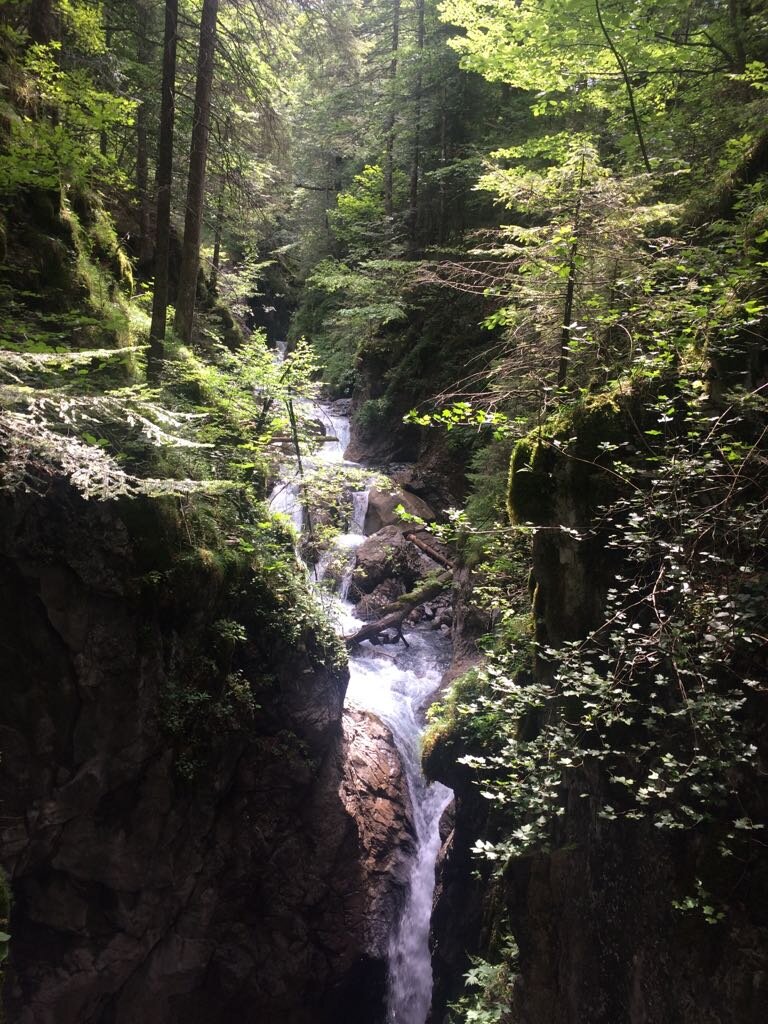
If you follow the Alvier river upstream, you will be rewarded with an intoxicating natural spectacle on the Kesselfall tour.

01:00 h duration
6,14 km Length
1160 m Highest point
985 m Lowest point
184 m Ascent
174 m Descent
Condition
Difficulty
Result
Landscape
Public transport

Bus line 580, bus stop "Brand Gemeindezentrum"

Timetable enquiry online at www.vmobil.at

Parking

At the parking lot of the Alvierbad

Directions

Trail run starting point at the Alvierbad - footpath into the valley - cross the Alvier in the Brügga district - road into the valley - forest path towards Kesselfall - Kesselfall - footpath out of the valley - Innertal - cross the bridge - from here take the same route back to the trail run starting point at the Alvierbad

Safety instructions

EMERGENCY CALL
140 Alpine emergencies Austria-wide
144 Alpine emergencies Vorarlberg
112 Euro-emergency call (works with any mobile phone/network)

www.alpenregion-vorarlberg.com/sicherheitstipps-wandern

Equipment

Running shoes, sun and rain protection, filled water bottle, snack (as desired) and first aid equipment. Mobile phone for emergencies.

Destination

Trailrun starting point at the Alvierbad

Starting Point

Trailrun starting point at the Alvierbad

Safety in the mountains

EN NOTRUF:

EN 140 - Alpine Notfälle österreichweit 

EN 144 - Alpine Notfälle Vorarlberg 

EN 112 - Euro-Notruf (funktioniert mit jedem Handy/Netz) 

Characteristics
Tour type Trail running
Difficulty Moderate
Start Bushaltestelle - Gemeindezentrum
Finish Bushaltestelle - Gemeindezentrum
Elevation profile
Best time of year
Jan
Feb
Mar
Apr
May
Jun
Jul
Aug
Sep
Oct
Nov
Dec