Revitalization of the Armatin High Trail
From a former torrent work trail to an informative hiking trail with a view
The Armatin High Trail above Bludenz has a long history. Originally created to secure the wild ravines above Bludenz and thus protect the town of Bludenz and the village of Nüziders, the path fell into disrepair over time. Thanks to the initiative of Karl-Heinz Dobler, the Vorarlberg Alpine Club and other helping hands, the path was repaired in 2023 and thus made accessible to hikers. This revitalization was the occasion to find out more about the history of the torrent constructions above Bludenz.
Read more about...
Historical background & general information
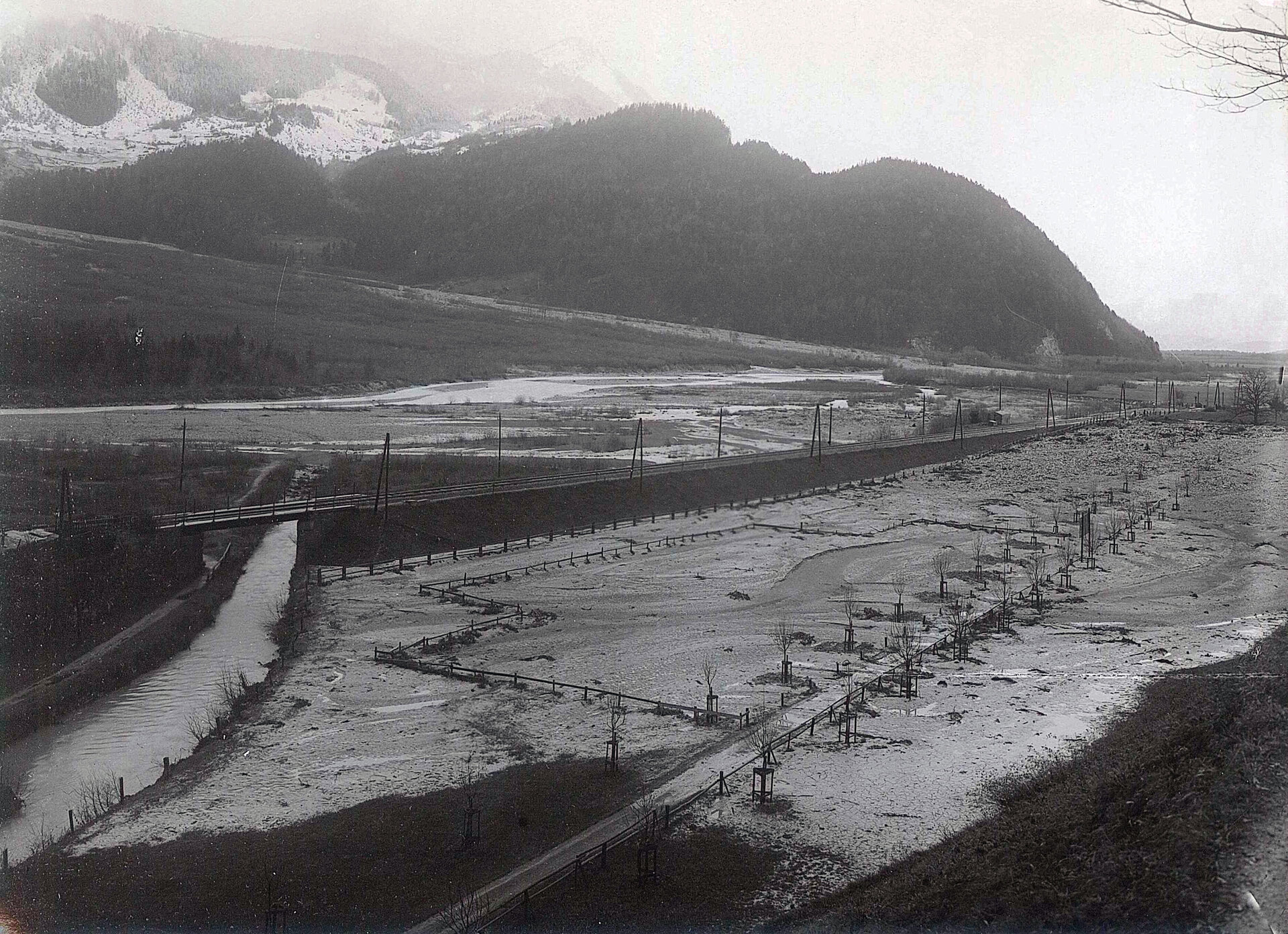
After a cold spell in December 1918, a thaw set in with heavy rainfall, which led to high runoff and a considerable bed load. The potential danger for the town of Bludenz and Nüziders became clearly visible during this flood. On this occasion, work began in 1919 on damming the Galgentobel. A first, larger project for the damming of the stream was drawn up in 1920, a supplementary project from 1927 envisaged above all the expansion of the damming in the Muttersberg ravine.
The Muttersberg and Mittewald ravines, whose catchment areas include the walls and scree slopes of the Elserspitzen and Breithorn, are particularly affected by bed load. The total catchment area of the Galgentobel covers a total area of 7.2 km². The Rosttobel and Mittewaldtobel join below the Elserspitzen to form the Galgentobel and take in the Muttersberg and Armatintobel at the Schwendeböden. Below the confluence of the Muttersbergtobel, the stream enters an approximately 1 km long rocky gorge that is difficult to access, then flows through the 2 km long alluvial cone and finally flows into the Ill as the Galgentobel.
The Galgentobel with its smaller and larger tributaries thus drains the entire southern slope of the Hoher Fraßens and the Elserspitzen. Today, the western part of the town of Bludenz and the eastern part of the village of Nüziders lie on the extensive debris cone of the Galgentobel. The ravine owes its unattractive name to a medieval place of execution, which was located to the east above the bridge on the old country road between Bludenz and Nüziders.
Torrent control and structures
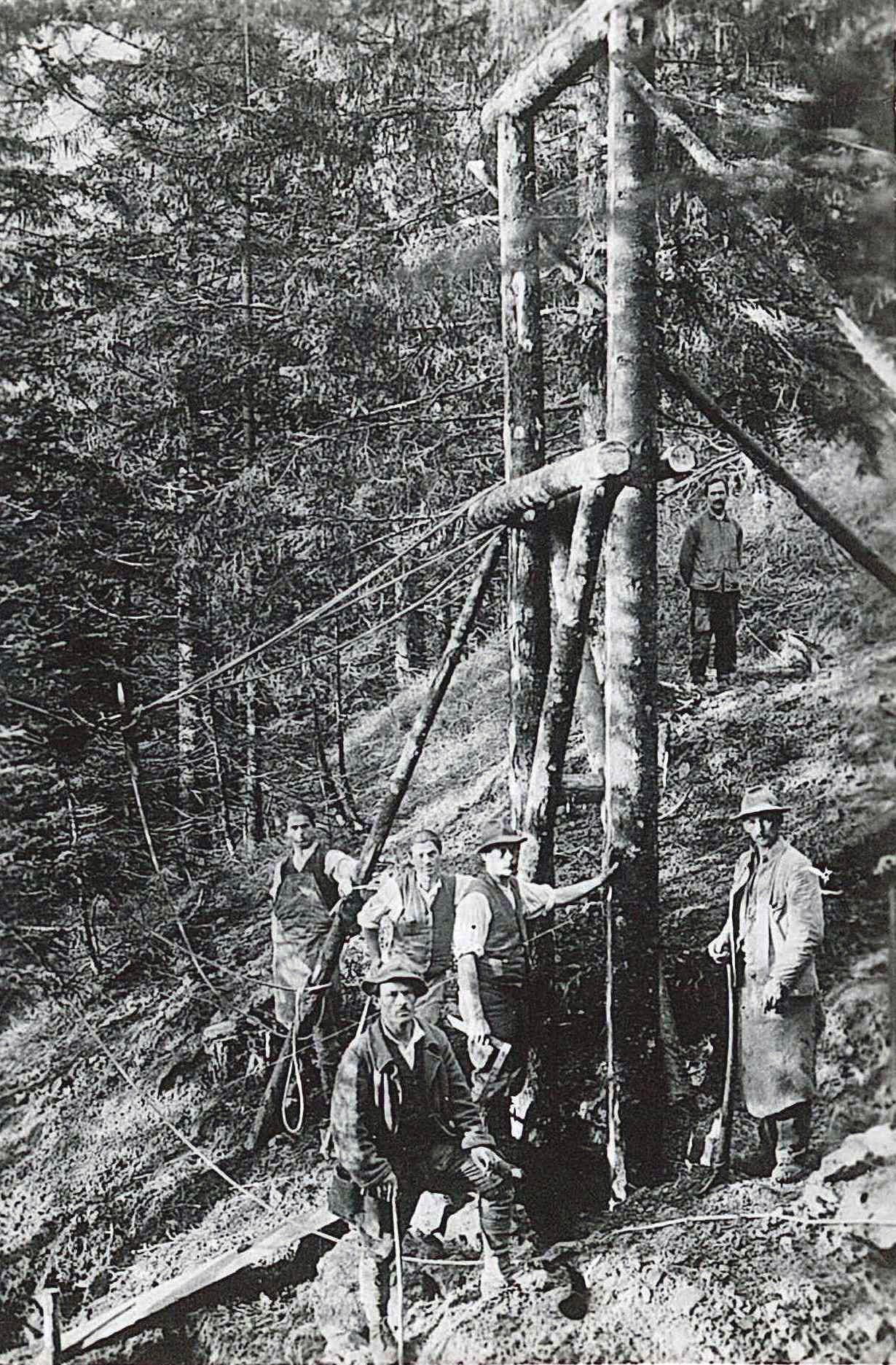
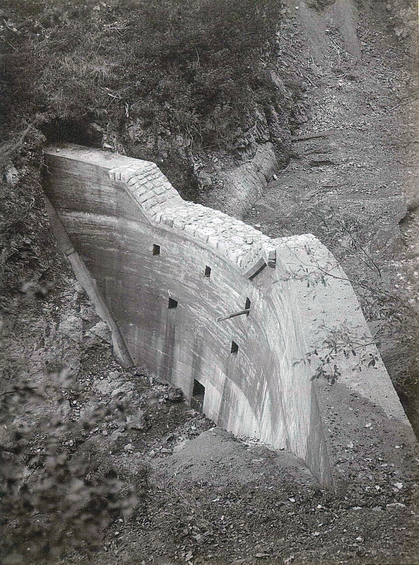
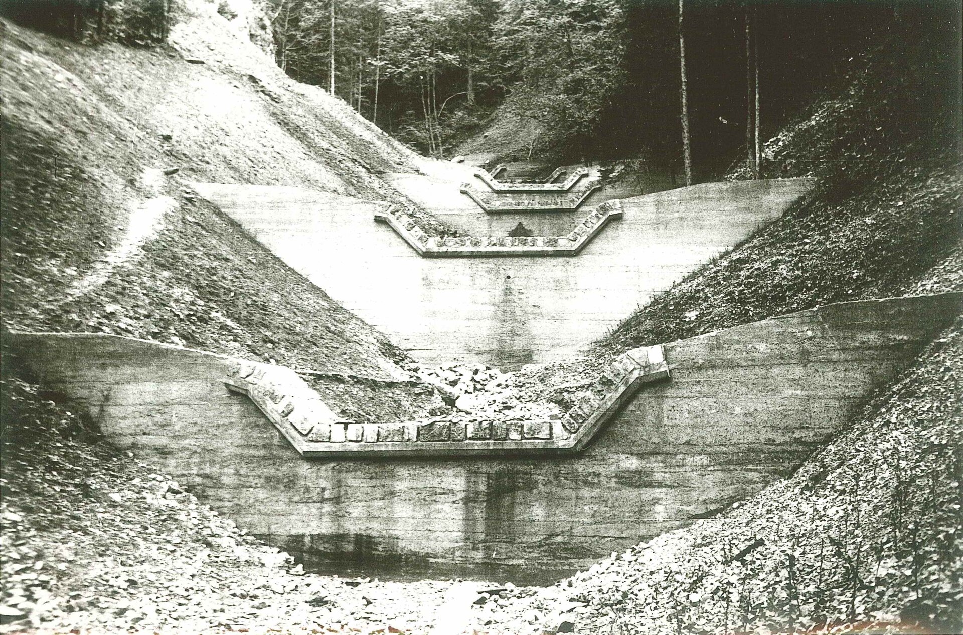
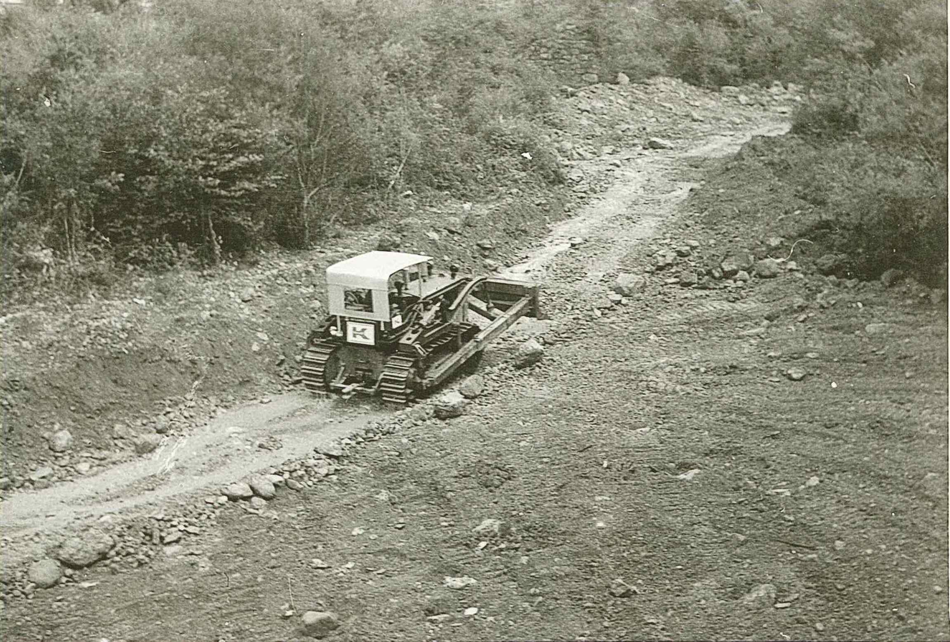
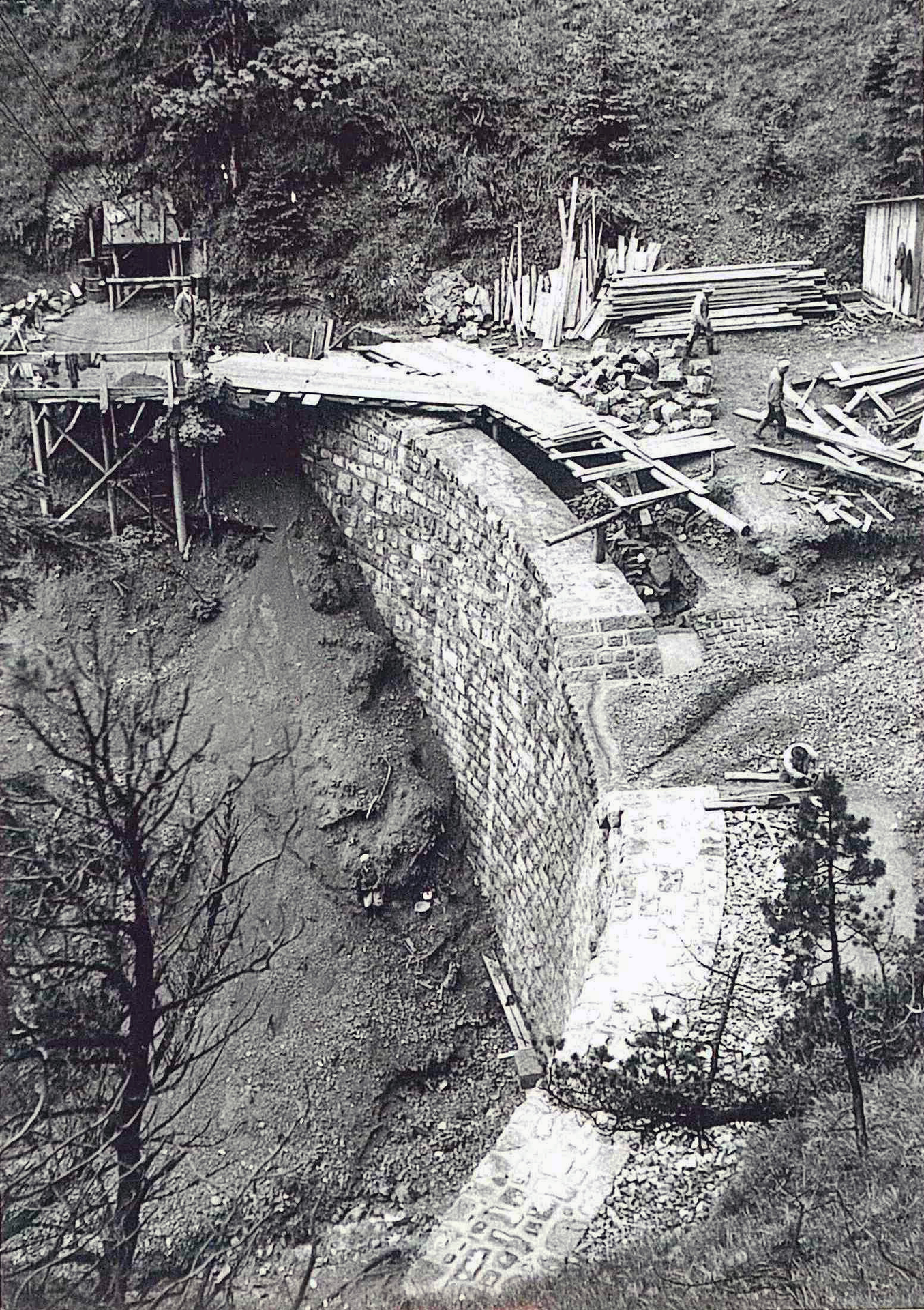
Since the start of the Galgentobel river engineering works in 1919, both smaller and larger projects have been continuously implemented to maintain, renew and update the structures in order to continue to ensure effective protection. In total, more than 100 transverse structures (barriers, bottom sills and bottom belts) and 3 bedload retention basins on the alluvial cone were built in the Galgentobel catchment area.
One of the first arch barriers was built at Muttersbergtobel - an impressive achievement for the time and the local conditions. People used to be able to read the terrain very well and therefore often found ideal locations for arch barriers. They were also aware that an arch dam made it easy to divert the static forces in mountain slopes.
Further projects (renovation work on dams, construction of additional dams) will also be implemented here in the future in order to protect the settlement area, the railroad and railroad infrastructure as well as the provincial roads from mudflows and floods.
As recent years have shown, the dam works well during medium floods, so that a total of 20,000 m³ of bedload could be deposited in the lower reaches almost without damage.

Bludenz water protection areas & drinking water supply
During the floods at that time, the large masses of water brought huge amounts of debris down to the valley. It took a great deal of hard work to prevent the streams in the lower reaches from bursting towards Bludenz and Nüziders. However, the spring taps and water pipes for the drinking water supply near the streams were completely destroyed at the time.
After the disaster, the torrent control department began the most urgent safety measures against further impending dangers in the course of the stream. In this project, which was developed for the river engineering, it was possible to unite the interests of the torrent, the drinking water supply and forest use. The construction of the headwaters and the new drinking water supply system required the development of the previously pathless area.
Large parts of the area below the Elserspitzen and the Furkla are now a water conservation area or protected area. Almost the entire town of Bludenz is supplied with drinking water from the springs on Muttersberg and Furkla. Only 10% is supplied by the Brunnenfeld groundwater pumping station. The town of Bludenz has very good water quality, as can be seen from the measurement results, which are carried out twice a year by the state's environmental institute. The supply network of the town of Bludenz is 53 km long and approx. 930,000 m³ of drinking water is supplied each year.
Sources:
- Archive of the Vorarlberg torrent and avalanche control - Bludenz area construction management
- Waterworks of the town of Bludenz
- Bludenzer Geschichtsblätter 137 (2022) - Bludenz Region History Society