2 adults

Rooms 1

walsertalsommer16_alexkaiser.at-0601

My accommodation

2 adults

A good choice for your holiday:
Alpenstadt Bludenz

  • 163 landlords and hosts
  • 34 lifts and cable cars
  • 123 kilometers of pistes
  • Pure nature

A good choice for your holiday:
Brandnertal

  • 163 accommodations
  • 34 lifts and cable cars
  • 123 kilometers of pistes
  • Pure nature

A good choice for your holiday:
Klostertal

  • 163 landlords and hosts
  • 34 lifts and cable cars
  • 123 kilometers of pistes
  • Pure nature

A good choice for your holiday:
Biosphere reserve Großes Walsertal

  • 163 holiday properties
  • 34 lifts and cable cars
  • 123 kilometers of pistes
  • Pure nature

Rooms 1

Hiking & Mountaineering

Mountain World Biosphere Reserve Großes Walsertal

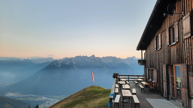
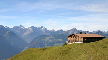
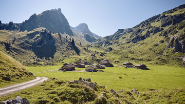
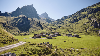
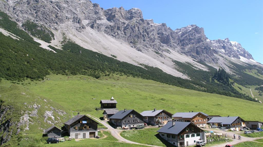
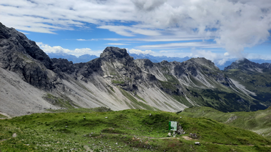
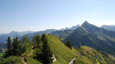
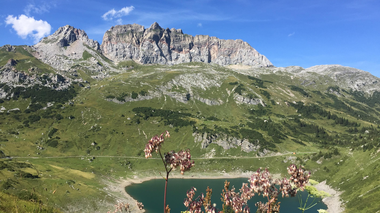
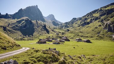
Majestically, the peaks of the Walser and Lechtal Alps frame the valley. Among the 40 mountain peaks, the Rote Wand rises to a height of 2704 meters. This scenically varied mountain landscape with its gorges, torrents, meadows and forests is home to a species-rich flora and fauna. Rugged, steeply rising cliffs alternate with magnificent blooming alpine meadows just waiting to be explored.

Our Most Beautiful Hikes and Mountain Climbing Routes

Marul - Alpe Faludriga - Schwarze Furka - Alpe Laguz | Raggal-Marul

Marul - Alpe Faludriga - Schwarze Furka - Alpe Laguz | Raggal-Marul

Marul - Alpe Faludriga - Schwarze Furka - Alpe Laguz | Raggal-Marul

Length14,4 km Elevation gain1534 m LevelDifficult Duration7:00 h

On this quite demanding tour, you will enjoy magnificent views of the mountains of the Grosses Walsertal Biosphere Park and move through the Faludriga-Nova core zone.

Hiking parking lot, Marul

Alpe Laguz, Marul

Bad Rothenbrunnen | Sonntag-Buchboden

Bad Rothenbrunnen | Sonntag-Buchboden

Bad Rothenbrunnen | Sonntag-Buchboden

Length5,2 km Elevation gain290 m LevelEasy Duration1:30 h

Enjoy the hike into the valley along the stream to the beautifully situated alpine inn Bad Rothenbrunnen in the Gadental valley.

Church, Sonntag-Buchboden

Church, Sonntag-Buchboden

To the Gadenalpe | Sonntag-Buchboden

To the Gadenalpe | Sonntag-Buchboden

To the Gadenalpe | Sonntag-Buchboden

Length6,7 km Elevation gain405 m LevelModerate Duration2:30 h

Leisurely hike from Buchboden to the Biosphere Park core zone Gadental.

Hiking car park, Sonntag-Buchboden

Hiking car park, Sonntag-Buchboden

Steris - Oberpartnom - Unterpartnom | Sonntag

Steris - Oberpartnom - Unterpartnom | Sonntag

Steris - Oberpartnom - Unterpartnom | Sonntag

Length9,9 km Elevation gain455 m LevelModerate Duration3:30 h

The panoramic hike from Alpe Steris over the Upper and Lower Partnom Alps is perfect for connoisseurs.

Sonntag-Stein cable car valley station, Sonntag

Sonntag-Stein cable car valley station, Sonntag

Hike in the Core zone Faludriga-Nova | Raggal-Marul

Hike in the Core zone Faludriga-Nova | Raggal-Marul

Hike in the Core zone Faludriga-Nova | Raggal-Marul

Length10,3 km Elevation gain616 m LevelDifficult Duration4:45 h

The Schwarze Furka is surrounded by an untouched, graceful mountain world with an incredible view. Immerse yourself in the biosphere park core zone.

Church, Marul

Church, Marul

Wangspitze, 1.873 m | Sonntag-Buchboden

Wangspitze, 1.873 m | Sonntag-Buchboden

Wangspitze, 1.873 m | Sonntag-Buchboden

Length13,8 km Elevation gain990 m LevelDifficult Duration5:45 h

Beautiful round tour from Buchboden to the Wangspitze and further into the biosphere park core zone "Gadental".

Parkplatz an der Lutz, Sonntag-Buchboden

Parkplatz an der Lutz, Sonntag-Buchboden

Wiesweg via Labom | Raggal

Wiesweg via Labom | Raggal

Wiesweg via Labom | Raggal

Length5,7 km Elevation gain155 m LevelEasy Duration1:45 h

Hike for the whole family along the Wiesweg to Grüneck on the Ludescherberg with magnificent panoramic views over the Walgau.

Church, Raggal

Church, Raggal

Wiesweg | Raggal - Ludescherberg

Wiesweg | Raggal - Ludescherberg

Wiesweg | Raggal - Ludescherberg

Length4,4 km Elevation gain98 m LevelEasy Duration1:15 h

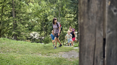
An easy hike for the whole family across flower-strewn meadows (especially in early summer) and always with a view of the Walserkamm on the opposite side of the valley.

Church, Raggal

Church, Raggal

Gampelin Alpe - Schnifis | Thüringerberg

Gampelin Alpe - Schnifis | Thüringerberg

Gampelin Alpe - Schnifis | Thüringerberg

Length11,3 km Elevation gain384 m LevelModerate Duration3:30 h

Discover the natural landscape from Thüringerberg to Schnifis.

Village centre, Thüringerberg

Village centre, Thüringerberg

Zafernhorn, 2.107 m | Fontanella-Faschina

Zafernhorn, 2.107 m | Fontanella-Faschina

Zafernhorn, 2.107 m | Fontanella-Faschina

Length9,5 km Elevation gain751 m LevelModerate Duration4:00 h

Around and up to the top of the Zafernhorn with breathtaking views of the surrounding mountain groups.

Car park Faschina, Fontanella

Car park Faschina, Fontanella

To the Seewaldsee | Fontanella

To the Seewaldsee | Fontanella

To the Seewaldsee | Fontanella

Length4,3 km Elevation gain112 m LevelEasy Duration1:00 h

The hike to the Seewaldsee is eventful from spring to autumn in any weather and offers a wonderful panoramic view over the Grosse Walsertal.

Fontanella-Säge, Fontanella

Seewaldsee, Fontanella

Hike to water places | Sunday-Buchboden

Hike to water places | Sunday-Buchboden

Hike to water places | Sunday-Buchboden

Length7,7 km Elevation gain100 m LevelEasy Duration2:30 h

Beautiful hike to special water places in the biosphere park Grosses Walsertal: Natural monument Kessi-Gorge, iron spring Bad Rothenbrunnen, tuff spring and sulfur spring.

Church, Sonntag-Buchboden

Church, Sonntag-Buchboden

Via the Stafelalpsee to the Fanz-Josef-Hütte | Fontanella-Faschina

Via the Stafelalpsee to the Fanz-Josef-Hütte | Fontanella-Faschina

Via the Stafelalpsee to the Fanz-Josef-Hütte | Fontanella-Faschina

Length4,5 km Elevation gain247 m LevelModerate Duration1:45 h

Leisurely hike for connoisseurs to the Stafelalpsee and further to the Franz-Josef-Hütte.

Parking lot at the Faschinajoch, Fontanella-Faschina

Parking lot at the Faschinajoch, Fontanella-Faschina

Along the Walserkamm | Blons - St. Gerold

Along the Walserkamm | Blons - St. Gerold

Along the Walserkamm | Blons - St. Gerold

Length17,5 km Elevation gain610 m LevelModerate Duration6:00 h

Very beautiful hike from alp to alp on the Walser ridge for enduring hikers.

Blons

St. Gerold

Via Fatnella Alpe to Fontanella | Fontanella-Faschina

Via Fatnella Alpe to Fontanella | Fontanella-Faschina

Via Fatnella Alpe to Fontanella | Fontanella-Faschina

Length7,5 km Elevation gain506 m LevelModerate Duration3:30 h

Leisurely hike from Faschina over the Fatnella Alpe to Fontanella.

Parking lot at the Faschinajoch, Faschina

Village center, Fontanella

From Raggal to the Hohe Frassen, 1,979 m | Raggal

From Raggal to the Hohe Frassen, 1,979 m | Raggal

From Raggal to the Hohe Frassen, 1,979 m | Raggal

Length9,7 km Elevation gain966 m LevelModerate Duration5:00 h

Beautiful circular hike from Raggal over the Klesialpe to the Hohen Frassen and over the Nitzkopf back to Raggal.

Village centre, Raggal

Village centre, Raggal

Alphüttenwanderung Damüls-Mellau-Faschina - Teil 1

Alphüttenwanderung Damüls-Mellau-Faschina - Teil 1

Alphüttenwanderung Damüls-Mellau-Faschina - Teil 1

Length13,6 km Elevation gain521 m LevelModerate Duration4:25 h

Kirchdorf Damüls - Alpe Oberdamüls - Stofel Kapelle - Alpe Unterdamüls - Türtschalpe

Kirchdorf Damüls

Fontanella

Damüls | Zur Alpe Unterdamüls

Damüls | Zur Alpe Unterdamüls

Damüls | Zur Alpe Unterdamüls

Length5,6 km Elevation gain180 m LevelEasy Duration2:00 h

Damüls Kirchdorf - Alpe Unterdamüls - Damüls Kirchdorf

Damüls Kirchdorf

Damüls Kirchdorf

Damüls-Faschina | Rundtour Faschina-Damüls-Faschina

Damüls-Faschina | Rundtour Faschina-Damüls-Faschina

Damüls-Faschina | Rundtour Faschina-Damüls-Faschina

Length11,0 km Elevation gain635 m LevelModerate Duration4:30 h

Faschinajoch - Hahnenkopf - Bergstation Glatthornbahn - Alpe Unterdamüls - Damüls Kirchdorf - Faschinajoch

Faschinajoch

Faschinajoch

Blasenka, 2.004 m & Hochlicht, 2.109 m | Fontanella

Blasenka, 2.004 m & Hochlicht, 2.109 m | Fontanella

Blasenka, 2.004 m & Hochlicht, 2.109 m | Fontanella

Length13,2 km Elevation gain1045 m LevelModerate Duration6:00 h

2-summit hike in the heart of the Great Walser Valley with a fabulous panoramic view.

Car park at the "Säge", Fontanella

Car park at the "Säge", Fontanella

Falvkopf, 1.849 m | Blons

Falvkopf, 1.849 m | Blons

Falvkopf, 1.849 m | Blons

Length12,4 km Elevation gain949 m LevelDifficult Duration5:00 h

An incredible mountain panorama awaits you on the Falvkopf, above Blons and part of the Walserkamm.

Community centre, Blons

Community centre, Blons

Faschina - Hochschere Fürkele - Buchboden | Faschina & Buchboden

Faschina - Hochschere Fürkele - Buchboden | Faschina & Buchboden

Faschina - Hochschere Fürkele - Buchboden | Faschina & Buchboden

Length15,8 km Elevation gain855 m LevelDifficult Duration6:30 h

The mountain tour over the Hochschere Fürkele and the Hochschere Weg is one of the most challenging mountain tours in the Großes Walsertal and offers fabulous views.

Parking lot Faschinapass, Fontanella-Faschina

Church, Sonntag-Buchboden

Gerenspitze, 1.871 m | St. Gerold

Gerenspitze, 1.871 m | St. Gerold

Gerenspitze, 1.871 m | St. Gerold

Length17,0 km Elevation gain1003 m LevelModerate Duration6:30 h

Beautiful hike via the Plansott Alpe to the Gerenspitze and back via the Gaßner Alpe with fabulous views of the Großes Walsertal biosphere reserve.

St. Gerold

St. Gerold

Hochgerach, 1.985 m | Thüringerberg

Hochgerach, 1.985 m | Thüringerberg

Hochgerach, 1.985 m | Thüringerberg

Length15,4 km Elevation gain1109 m LevelDifficult Duration6:15 h

The Hochgerach is the second highest mountain of the Walserkamm and a worthwhile peak.

Village center, Thüringerberg

Village center, Thüringerberg

Löffelspitze, 1.962 m | Blons - St. Gerold

Löffelspitze, 1.962 m | Blons - St. Gerold

Löffelspitze, 1.962 m | Blons - St. Gerold

Length21,6 km Elevation gain1190 m LevelModerate Duration7:30 h

One of the most beautiful mountain tours leads past the Sentum Alpe up to the Löffelspitze at 1,962 m.

Blons

St. Gerold

Glattmar, 1.930 m | Sonntag-Stein

Glattmar, 1.930 m | Sonntag-Stein

Glattmar, 1.930 m | Sonntag-Stein

Length9,3 km Elevation gain632 m LevelModerate Duration4:00 h

A beautiful hike to Glattmar with breathtaking mountain panorama and cozy alpine stop.

Mountain station cable car Sonntag-Stein, Sonntag

Mountain station cable car Sonntag-Stein, Sonntag

Kellaspitze, 2.017 m | Raggal-Marul

Kellaspitze, 2.017 m | Raggal-Marul

Kellaspitze, 2.017 m | Raggal-Marul

Length9,6 km Elevation gain1058 m LevelDifficult Duration5:30 h

Beautiful mountain tour with partly somewhat exposed and rope-secured sections to the summit of the Kellaspitze with a fabulous panoramic view.

Hikers' car park Marul, Raggal

Hikers' car park Marul, Raggal

Breithorn, 2.081 m | Sonntag-Stein

Breithorn, 2.081 m | Sonntag-Stein

Breithorn, 2.081 m | Sonntag-Stein

Length14,2 km Elevation gain1074 m LevelModerate Duration6:00 h

Challenging mountain tour for sure-footed hikers in the heart of the Grosses Walsertal Biosphere Park.

Sonntag-Stein cable car mountain station, Sonntag

Sonntag-Stein cable car mountain station, Sonntag

Glatthorn, 2.133 m | Fontanella-Faschina

Glatthorn, 2.133 m | Fontanella-Faschina

Glatthorn, 2.133 m | Fontanella-Faschina

Length5,9 km Elevation gain365 m LevelModerate Duration3:30 h

Summit tour on the Glatthorn above Faschina with fabulous views of the surrounding mountains.

Car park at the Faschinajoch, Fontanella-Faschina

Car park at the Faschinajoch, Fontanella-Faschina

Information about the current situation:

Current situation:

close

A short moment

We prepare the content…