Montikel panoramic trail | Bludenz

Distance4,6 km

Elevation gain205 m

Negative altitude223 m

LevelEasy

Duration1:45 h

Distance4,6 km

Elevation gain205 m

LevelEasy

Duration1:45 h

A short moment

Loading map...

Montikel panoramic trail | Bludenz

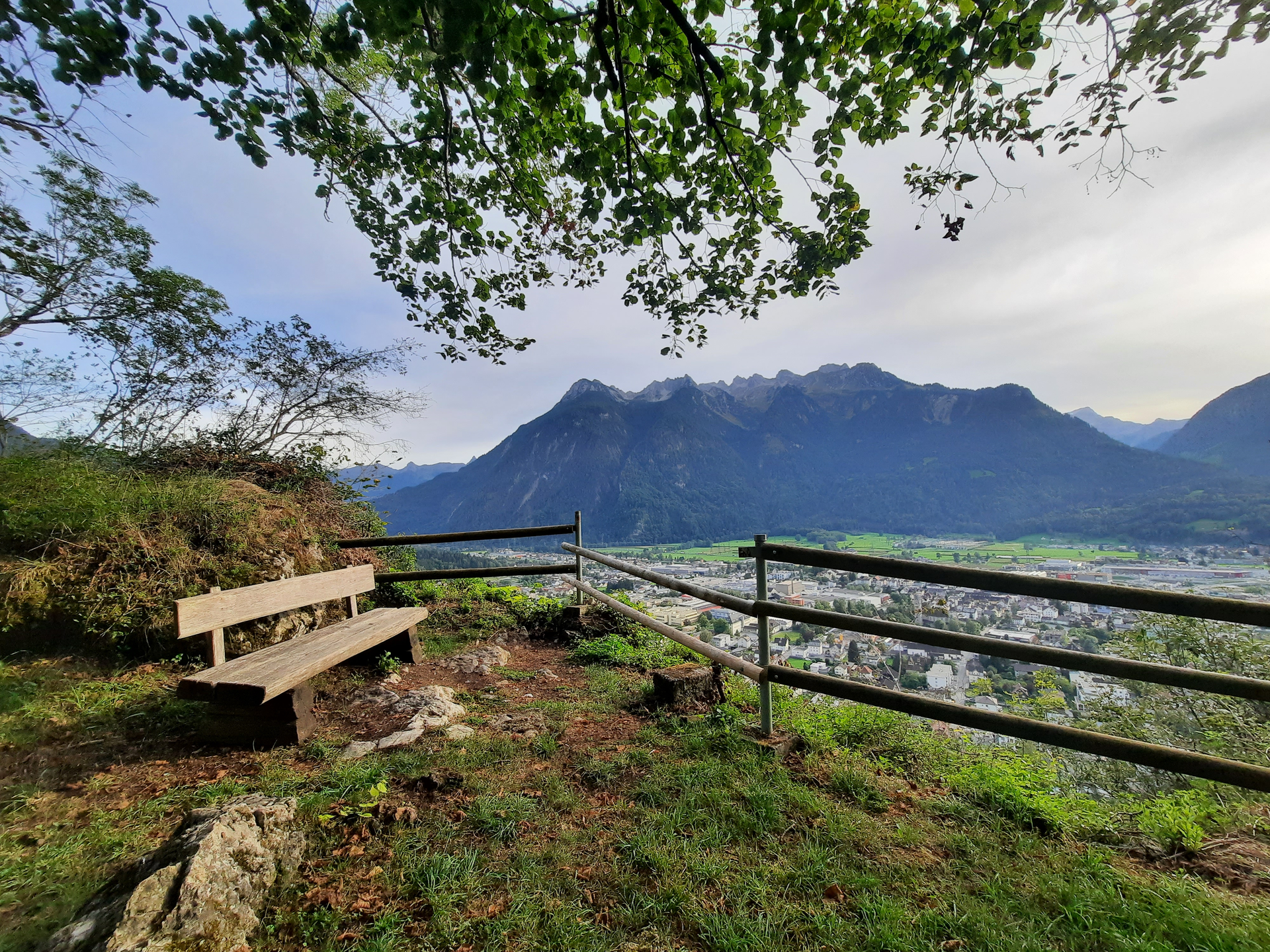
This tour starts near the St. Laurentius church at the stop "Bludenz Krankenhaus". Here the hiking trail leads past the Bludenz Social Center and thus immediately joins a forest path. Following the forest path, you will reach the Montikel via several small hairpin bends. On the Montikel, numerous benches and viewing points await you, where you can enjoy the breathtaking panorama of Bludenz. Follow the hiking trail further towards Rungelin and enjoy the views over the city. At a fork in the road, follow the sign towards "Halde" and descend into the Halde district. At the junction with the road "Haldenweg" keep to the right and walk past the Val Blu leisure pool in the direction of the town center. Alternatively, take the bus back to the town center.

Author's recommendation

Enjoy the beautiful view over the alpine town of Bludenz.

Equipment

Ankle-high mountain boots with tread sole, sun and rain protection, snack, filled water bottle and first aid kit. Cell phone for emergencies.

Route description

Start: Water castle (on the right hand side of the valley station Muttersbergbahn), Bludenz

End: Leisure pool VAL BLU, Bludenz

St. Laurentius Church - Social Center - forrest path - Montikel - turnoff towards Halde - Halde - Haldenweg - Val Blu leisure pool - possibly continue towards the city center

Properties

  • Linear route
  • Scenic
  • Family-friendly
  • Refreshment stops available

Emergency services

140 Alpine Emergencies throughout Austria

144 Alpine Emergencies Vorarlberg

112 Euro emergency call (works with any mobile phone/network)