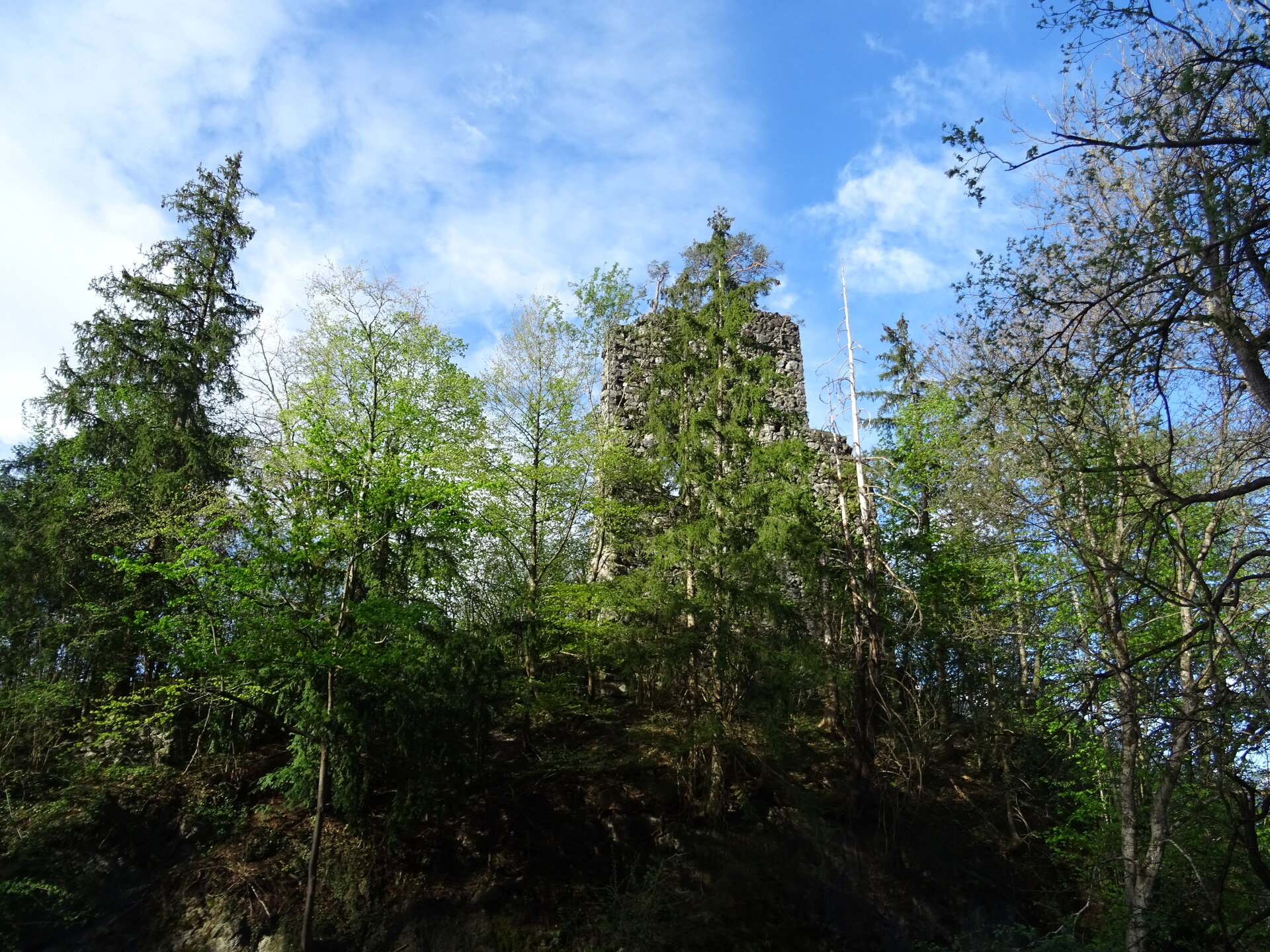
Circular trail to Sonnenberg Ruin ​|​ Nüziders

Easy
Family-friendly
Round trip
Hiking trail · Nüziders

A scenic hiking trail above Nüziders, past the Sonnenberg ruin.

01:15 h duration
3,66 km Length
718 m Highest point
553 m Lowest point
159 m Ascent
165 m Descent
Condition
Difficulty
Result
Landscape
Public transport

Bus line 530 or line 560, stop "Nüziders Postamt"

Timetable request online at www.vmobil.at

Parking

Parking places in the village centre of Nüziders

Directions

Nüziders village centre (follow signs) - Außerbach - Bad Sonnenberg inn - Bitschweg junction - Bitschweg - Außerberg - Plattenweg - Auf der Platte - Bad Sonnenberg ruins - Schloßweg - Burggasse - Nüziders village centre

Safety instructions

EMERGENCY CALL

140 Alpine emergencies Austria-wide

144 Alpine emergencies Vorarlberg

112 Euro-emergency call (works with any mobile phone/network)

www.alpenregion-vorarlberg.com/sicherheitstipps-wandern

Equipment

Ankle-high mountain boots with tread sole, sun and rain protection, snack, filled water bottle and first aid kit. Cell phone for emergencies.

Destination

Village centre, Nüziders

Starting Point

Village centre, Nüziders

Safety in the mountains

EN NOTRUF:

EN 140 - Alpine Notfälle österreichweit 

EN 144 - Alpine Notfälle Vorarlberg 

EN 112 - Euro-Notruf (funktioniert mit jedem Handy/Netz) 

Characteristics
Tour type Hiking trail
Difficulty Easy
Start Gemeinde Nüziders
Finish Gemeinde Nüziders
Elevation profile
Best time of year
Jan
Feb
Mar
Apr
May
Jun
Jul
Aug
Sep
Oct
Nov
Dec